Undo Limitations.
Redo Possibilities.
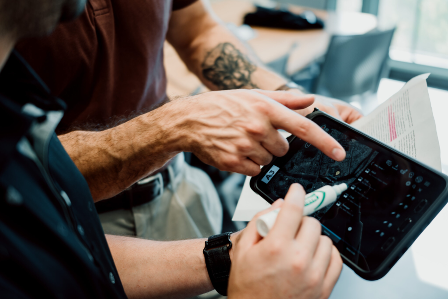
CTRL+Y engineers purpose-driven AI and operational software for emergency response, search and rescue, and public safety — tools that perform when conditions are most critical.
Built for Operations.
Not Demos.
Designed by people who've been in the field, for teams who can't afford failure.
AI-Assisted Search & Rescue
Detection models built for the hard cases — dense vegetation, rubble, low light, water. Not repurposed from consumer AI.
Drone & Telemetry Integration
Live drone feeds and field sensor data pulled into a single picture — from the air to the command post, in real time.
Operational Intelligence
Tools that give incident commanders a clear picture fast. Not more data to dig through.
Agency Workflow Software
Software that fits how agencies actually work. Not the other way around.
Intelligence
in Motion.
Monitor drones, telemetry, and communications through a unified real-time operational layer — from the field to command.
Explore the Platform

The People Who Run Toward Crisis Deserve Software Built With the Same Conviction.
Emergency response, search and rescue, and public safety work demands tools that are reliable, intelligent, and designed for reality — not demos. The margin for error is zero.
We build software that earns trust in the field. That means integrating modern AI and machine learning with the operational knowledge of the people who actually use it — every hour, every mission, every condition.
“ Technology that matters isn't built for ideal conditions.
It's built for the moments when conditions have already failed. ”
What We're Building
Focused tools for the work that counts.
AI Person Detection
Models trained for SAR — not repurposed from consumer AI. Built for rubble, dense canopy, low light, and open water.
Multi-Drone Coordination
Coordinate multiple UAVs across a search area. Automated coverage patterns, manual override, and live feed aggregation — all in one place.
Search Sector Planning
Smarter search grids. Terrain-aware sectors, probability weighting, and resource allocation so every team covers ground with purpose.
Live Telemetry Dashboards
GPS tracks, team status, sensor feeds, and comms in one screen. Updated in real time. Works offline when connectivity drops.
Agency Workflow Tools
Replaces clipboards and disconnected spreadsheets. Designed around how agencies actually plan, brief, and document — not around assumptions.
Field Communications
When towers are down and radios are spotty, teams still need to talk. Built for the worst conditions, not the best.
One System. Detection, Telemetry, Coordination.
Built for SAR. Deployed in the field. BISHOP puts aerial detection, live telemetry, and team coordination in a single hardened platform — no internet required.
- Live aerial detection, on-device
- TAK integration for field teams
- Offline-capable, edge-deployed
- Drone, ground, and command — unified
How We Think About Building
Intelligence that works in practice — not just in controlled conditions.
Machine Learning at the Edge
Our models are engineered for edge deployment — running inference directly on drones, field devices, and embedded systems without requiring constant connectivity. When the network fails, the intelligence keeps working.
Human-Centered AI Design
AI should amplify human judgment, not replace it. We design systems that surface intelligence to decision-makers — giving responders better information faster, while keeping humans in command of critical choices.
Field-Informed Engineering
We build with practitioners, not just for them. Every interface, workflow, and system is stress-tested against real operational constraints — cold fingers, degraded comms, time pressure, and fatigue.
Systems Integration
Our software is built to connect — with TAK, GIS platforms, existing agency databases, communication systems, and hardware ecosystems. We extend what agencies already have rather than replacing it.


The People Behind the Work
A small, focused team building at the intersection of advanced software, machine learning, and real-world operational impact.
Product designer and strategist shaping the user experience, design systems, and organizational direction of CTRL+Y.

Machine learning engineer focused on computer vision models for SAR detection and edge-deployed inference systems.

Full-stack engineer building the operational software and telemetry infrastructure that powers CTRL+Y's field systems.
Ready to Build Something That Matters?
We work with agencies, emergency services, and mission-driven organizations. If your work demands it, let's talk.